It appears that snow is definitely on the way to a large part of Denmark this evening. The question remains: where and how much?
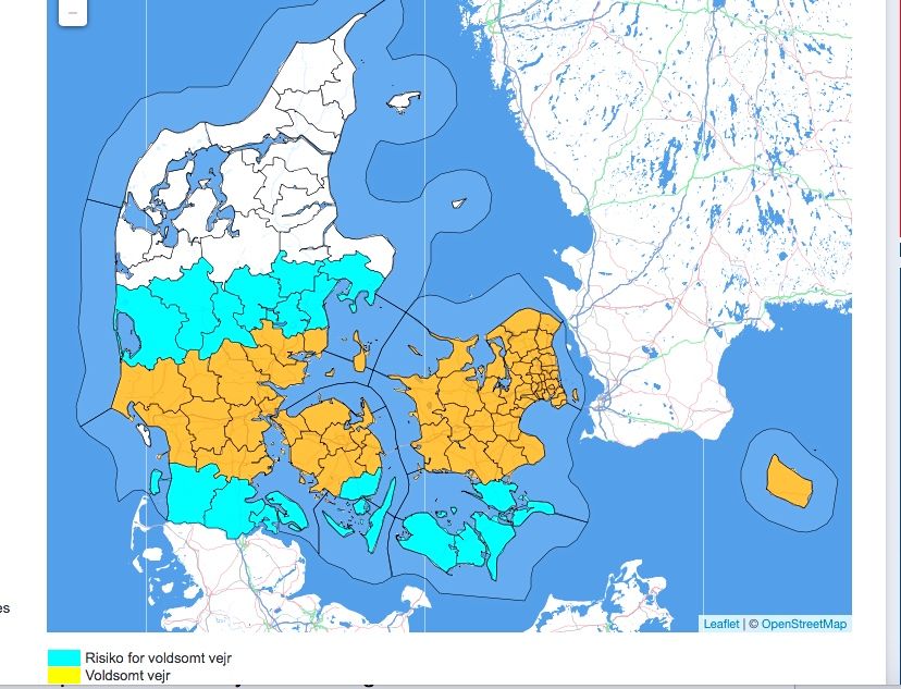
The current forecast predicts that a band of snow will form over the central part of Denmark at about 17:00 this afternoon and dump a large amount of snow over central Jutland, Zealand and mid-Funen – including Copenhagen and the Capital Region – and continue until Friday morning.
A moving target
DMI predicts between 5 and 15 cm of snow in the affected area (marked in yellow), with some places getting as much as 20 cm before it all ends tomorrow.
“It is a difficult and complex situation to predict,” DMI meteorologist Lars Henriksen told Ekstra Bladet. “It all depends on a low pressure system due to hit the southern part of the country this evening.
Henriksen said that a 50 km shift of the location of the low pressure system either way would have a major impact on the location and severity of the storm.
“As it stands now, we expect the most snow in the central parts of the country,” he said. “But it will not be until this evening, when the system actually arrives that we can say more where the heaviest snow will fall.”
Copenhagen could see 10 cm in an hour
According to the latest radar predictions, 5-10 cm of snow will fall on Copenhagen in just one hour between 7 and 8 pm tonight.
In total, 14 cm will fall, even though just hours ago, DMI was predicting the snowfall would mostly be sleet and snow and would mainly fall south of the Capital Region.
The last time, it snowed in the capital (a couple of weeks ago), barely half this fell over the course of a day.
Traffic headaches
Henriksen warned that should the snow get heavy, it will cause major traffic problems in certain areas.
Don’t count on the snow hanging around for long. Friday’s temperatures will be heading well above the freezing point and start melting the snowfall.

